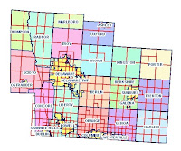
 http://www.dalisproject.org/images/cadastral_map.jpg
A Cadastral map is a map that gives information about real property. An example of a Cadastral map is a map that shows the city of Jacksonville, within the city it portrays the different parts of Jacksonville such as Orange Park or Arlington. The point of a Cadastral map is to give as much information for a particular piece of land as possible, for example tax records of the residents, zoning of the land, etc.
No comments:
Post a Comment