http://www.tceq.state.tx.us/assets/public/gis/images/drg.gif
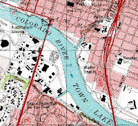
A Digital Raster Graph portrays a topography image from the U.S. Geological Survey that has been scanned into a computer. After being scanned, a DRG still shows borders, streets, and the non flat features look as if they were flat. For example, in the DRG above, you can see the buildings in the black, the streets, and the borders of the area and the river.
No comments:
Post a Comment